Squish, squish, squish. My feet sank up to my ankles with each footfall as I sprinted through a bog along Ireland’s Wild Atlantic Way.
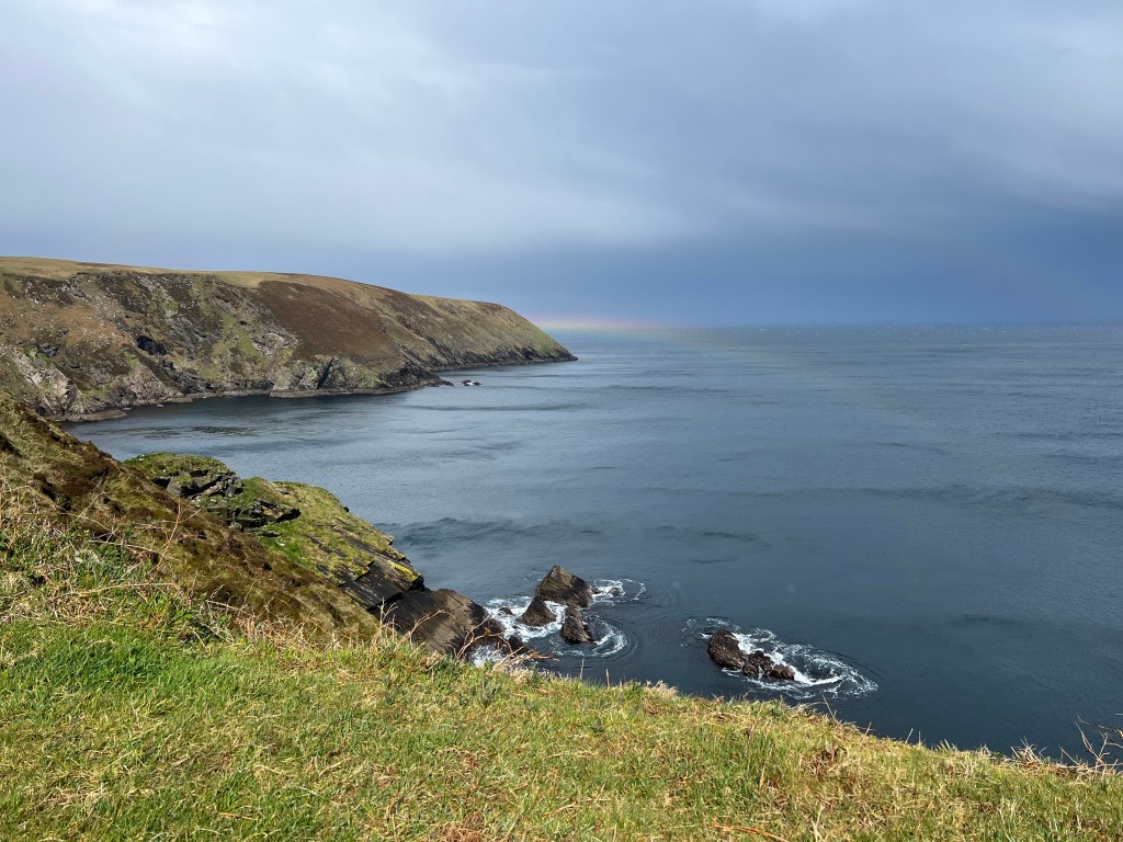
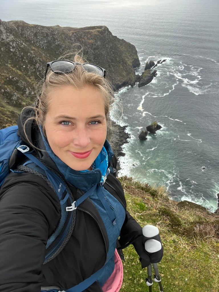
I had just hiked to Erris Head on the tip of a peninsula in northwest County Mayo. It had been a hike straight from a postcard: lush fields, newborn lambs, bluebird skies and rugged coastline. It was exactly what I had hoped the Wild Atlantic Way would be when I planned a solo road trip in April 2023.
As I reached the best part of the hike, the very tip of the Mullet Peninsula, the wind picked up and was howling so hard that I could barely snap a usable photo. Off the coast I saw what looked to be a mean squall headed my way. I snapped a few more photos and videos, laughing at the wild wind and crashing sea and how it felt a little dangerous standing 5 feet from the edge.
On the way back to the parking lot, I scurried up an ascent as fast as I could, following periodic trail markers. I still had about a mile to go and since I was doing a loop, I was on new territory.
The squall hit with the power of what felt like a hurricane to someone who grew up in the relatively tranquil Arizona desert. The wind and driving rain were thankfully at my back but felt strong enough to lift me off the ground and carry me halfway to Scotland. I glanced to my right and saw the squall blowing sideways across the rugged landscape.
At some point I lost the trail and began sprinting through the bog.
Luckily I had a downloaded trail map and pulled out my phone, quickly realizing I needed to go due south for a bit to get back on track. Squish, squish, squish went my feet as I righted myself and found the trail. Within 15 minutes it was over and the blue skies returned. A rainbow began to form in the distance off the northern tip of the peninsula.

Between the calories I had burned and the rush of adrenaline and a brief moment of mild panic, I felt almost high with joy. I was soaked, out of breath and stupid happy.
Welcome to the Wild Atlantic Way, I thought.
I began my trip along the coast on April 7 in the north’s County Donegal and ended 12 days later in Kinsale, the southernmost part of the Wild Atlantic Way. Below are the highlights of each leg.
I drove the entire journey solo. Some days there was so much driving I was completely gassed by the time I arrived in a new destination so keep that in mind when planning your own journey. When it doubt, simplify.
Donegal and Slieve League (3 nights)
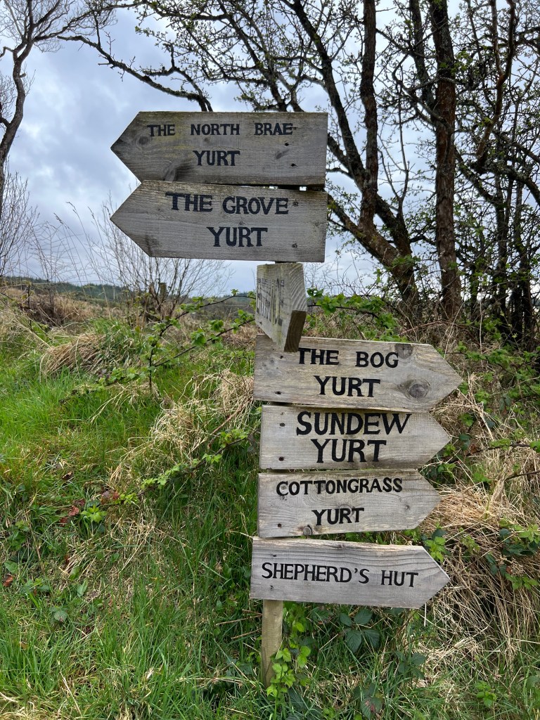
A 2-mile dirt road leading to a tiny lake and a yurt introduced me to the Wild Atlantic Way. It was the end of a long day road tripping from Belfast up to the north coast and then over to Derry before heading southwest about 90 minutes to County Donegal, the northernmost part of the Wild Atlantic Way.
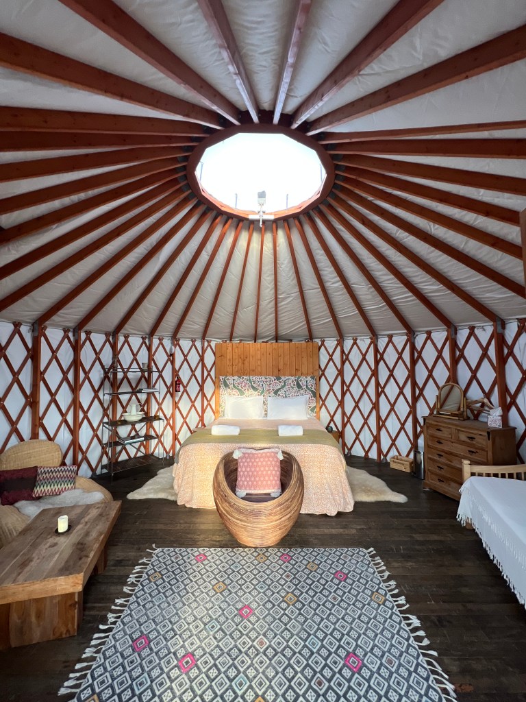
The yurt owner’s written directions and my downloaded map of the region got me there perfectly just as the sun was setting. I was the only person in the communal main lodge when I picked up my key, lanterns and reading lights from a little locker and headed to the electrify-free yurt, which sat alone in a bog, surrounded by trees and brush.
It was cleverly named the Bog Yurt.
It was cold, somewhere around 45 degrees. Despite the instructions and some experience building fires, I couldn’t get my stove to stay lit and I had no idea what to do with the provided water bladders that were supposed to help keep me warm. I later learned that you have to fill them with hot water from a kettle and then put them in your bed.
Without a fire or the hot water bladders, I slept fully clothed with my knit cap on. It was quite cold but not insufferable. I didn’t love having to gear up and walk to the main lodge to use the bathroom at midnight but overall it was quiet and a bit romantic, even if I was alone.

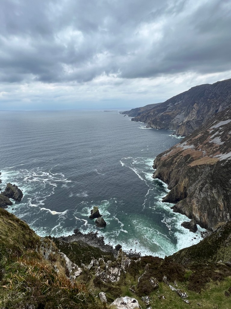
The next morning I was bleary-eyed but brimming with excitement about the day ahead. I made myself some breakfast and hit the road, heading for the cliffs at Slieve League. What I didn’t think about was the fact that it was the Saturday of Easter weekend and the cliffs would be packed with visitors.
Even though I arrived fairly late around noon, I got one of the last parking spots at what’s known as the lower lot, the first parking lot after the visitors’ center on the way up to the trailhead (it was too busy for the parking attendant to let me drive up the much more convenient upper lot, which added 2 miles roundtrip to my walk).
It was far busier than I wanted it to be at the trailhead, with big groups of tourists and locals alike and much shouting and crowding. Not my scene.
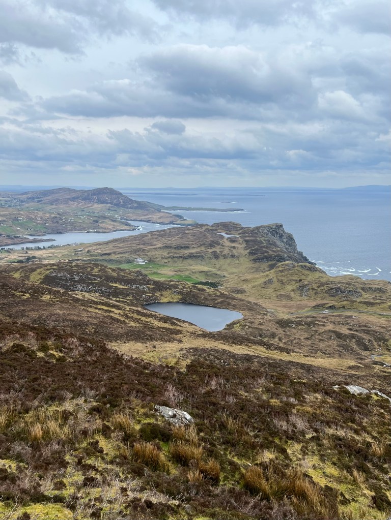
I questioned whether I’d be able to enjoy my day but decided to keep climbing, knowing that most of the tourists wouldn’t go much more than a mile in. I was right. After about 20 minutes of climbing, I reached the point where most people turned around and kept going.
I spent the next couple of hours continuously climbing until I reached a point known as Crockrawer, where I snacked on a scone with butter and jam. Along the way, I came across very few people and I ate my little snack in total solitude as I took in views of the rugged coast to the west and rolling hills to the south.
The next day I had ambitious plans to drive up to the northernmost part of Ireland and go to Glenveagh National Park, Horn Head and Fanad Head Lighthouse. I also hoped to hike three hours up a mountain called Errigal. Unfortunately, it was a total rainout and I had to pivot, instead taking a short drive to town, doing some shopping and visiting the worthwhile Donegal Castle before returning to the yurt for a relaxing, candlelit evening of reading, listening to old Irish records and life without WiFi. In short, bliss.
Erris Head, Achill Island and Westport (1 night)
The morning I left County Donegal, I could have driven an hour and been at my next destination. Instead, I gambled on the weather and drove well out of my way to Erris Head.
As I described above, I ended up experiencing a wild hike that filled me with joy. I did get a little battered during the Atlantic squall but I regrouped and headed for Achill Island, recently made famous as the setting for the Oscar-nominated “The Banshees of Inisherin” starring Colin Ferrell and Brendan Gleeson.
I drove an hour south from Erris Head and arrived to Achill without a plan. I had read about a beautiful drive to Minaun Heights, the top of the island. Since the weather was pleasant, I began snaking my way up a narrow road abutting steep drop-offs.
“How could two cars possibly fit here?” I asked myself, grateful I hadn’t come during peak season and didn’t have to share the road with oncoming cars.
It was a beautiful drive and happily, a short one. As I pulled up to the top of the mountain, I saw a man visibly shivering and hugging his jacket closer. Somewhat confused, I bundled up, thinking, “How bad could it be?”
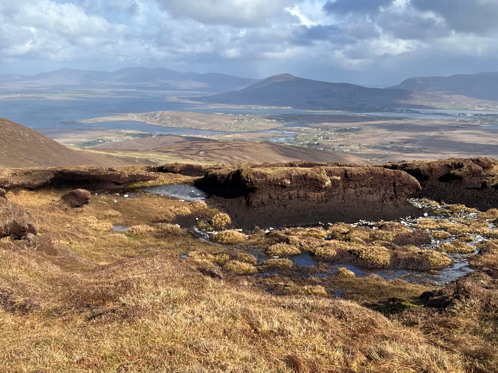
It was bad. The wind was howling. I could not believe how powerful it was. The skies were clear but it was blowing my body even more than the Atlantic squall had at Erris Head. I fought the gusts as I walked toward the viewpoint.
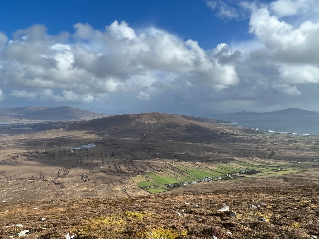
I nearly lost my breath as I looked out at the island sparkling in the waning sunlight. Bogs, beaches and rolling hills spready out below. It was stunning.
I turned back toward the car and noticed a trail going even higher and a man
and woman coming down. As we crossed paths I asked them what it was like up
there.
“Dangerously windy,” the Irishman said, adding that he felt like it could have easily knocked him down the mountain.
“OK, so I won’t be doing that,” I said and then noticed the woman’s knit cap.
“Does that say Arizona Cardinals?” I asked.
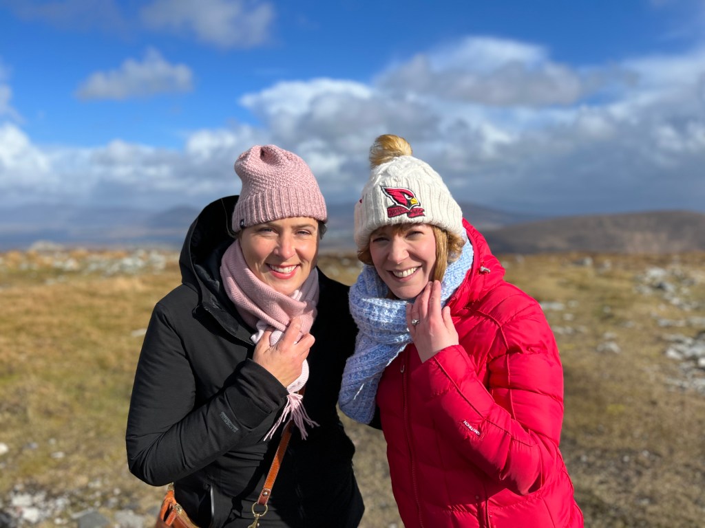
Their eyes lit up: “It does!”
They then explained that they had been in Phoenix for work and I explained that I grew up there.
“Small world,” we agreed.
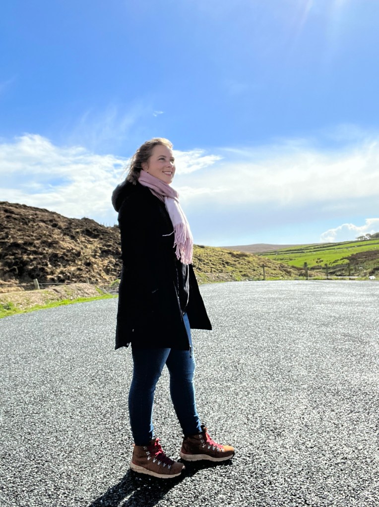
They advised me to walk a bit further for some different views, though not to the top of the trail they had been on. We snapped a photo, and I walked on and arrived to a saddle in the mountains. The wind roared even wilder and I had to remove my knit cap because it felt like it would fly away. Even though my hair was up the wind ripped dozens of tendrils away and blew them straight up.
I looked out toward the north to an incredible view of Keel Beech as frothy waves crashed ashore. Incredibly, it was even more beautiful than the viewpoint that I had walked away from five minutes earlier.
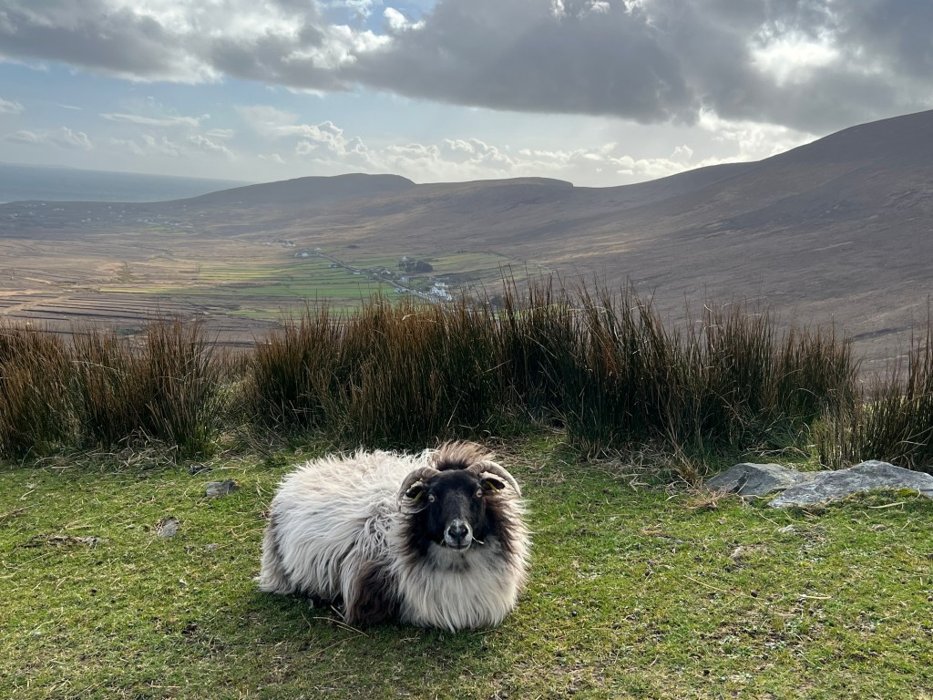
Soon after I drove back down the mountain, stopping to roll down my window and say hello to the sheep grazing on the side of the cliff road. Satisfied with my taste of Achill Island, I decided to get to Westport before it got too dark.
An hour later I arrived at Westport Heights, a B&B overlooking the charming seaside town and the dramatic Croagh Patrick in the background.
The B&B was connected to the town via a pedestrian path, so I walked down for an unmemorable dinner at Coveys Gastrobar, then turned in early to prepare for another big day of driving in the morning.
Connemara Mountains and Clifden (3 nights):

I awoke with ambitious plans to climb Croagh Patrick, a hard, four-hour hike.
Looking out the window, I realized my weather luck had run out. It was drizzly and foggy and had that look of a place that’ll be socked in for the day. A bit dejected, I ate my breakfast downstairs and formulated a new plan: to visit Westport House, a privately owned historic home built in 1730.
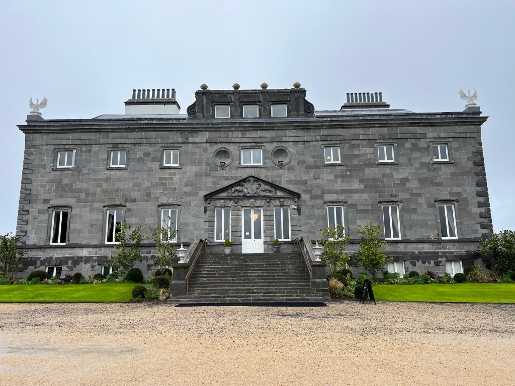
I packed up the car and drove about 10 minutes to the stately manor, which was both beautiful and fascinating. I spent roughly an hour there, shaking the hand of the Angel of Welcome on the grand staircase, wandering around the dungeons downstairs and picturing what life must have been like as I gazed at the opulent master bedroom. I also had a lovely chat with the woman working the front desk, who wanted to hear all about my solo travels and had some great tips for my journey.
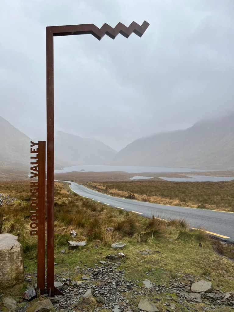
Next I drove through light fog and rain down the coast and through the Doolough Valley, which was stark and eerie given the weather. I can only imagine how beautiful it is on a sunny day. I stopped at the Doolough Valley Famine Memorial and learned how hundreds of hungry residents of nearby Louisburgh trekked to Delphi Lodge during the great famine in 1849 only to be angrily turned away. Many died of hunger and exposure on the walk back through the valley.
I could picture the caravan of needy people as I looked at the misty mountains surrounding me. It was a somber and powerful stop.
I continued to make my way through the valley, stopped for a short and wet but beautiful walk at the impressive Aasleagh Falls. Like the famine memorial, this stop is right off the road and an easy one to fit in.
Sick of being wet and cold, I finally headed toward my Airbnb along the Sky Road in Clifden, which sits between the Atlantic and the Twelve Bens mountains and is considered the capital of the breathtaking and vast Connemara region. All in all, I had been on the road for five hours, including my many stops. A direct drive would have taken just over an hour. Though worth it, I was tired.
That night in Clifden, I hunkered down with some soup and did some work as a gale blew outside. I was glad I hadn’t had to drive through it.
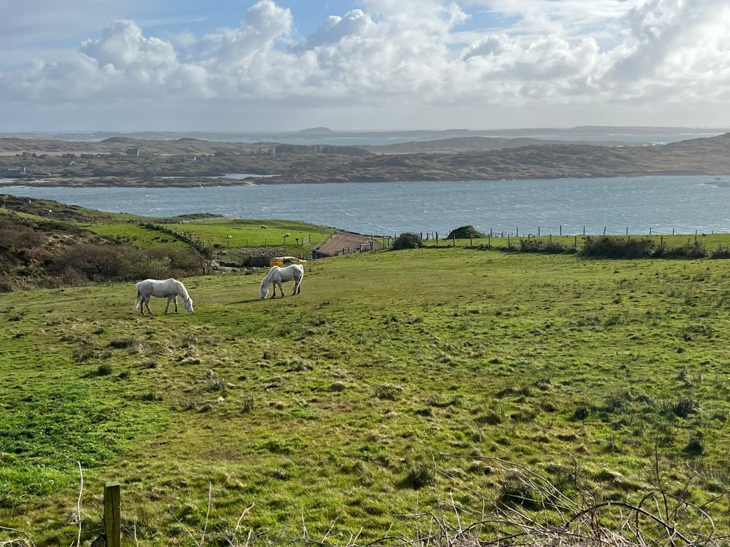
The weather in the morning was still sketchy so I had a lazy introduction to the day, starting by greeting the two Connemara ponies that live in a pasture in front of the Airbnb. Feeling certain the weather wouldn’t clear up, I decided to drive 10 minutes to town and treat myself to a new a book and lunch in Guys Bar, where I ate seafood chowder and chips in a cozy, dimly lit corner.
The weather cleared in the afternoon but I had to work. Unable to resist a little sunshine that evening, I decided to take a break and walk 15 minutes to Clifden Castle, a ruin that overlooks the coast and is at the end of a country road that passes private farms of Connemara ponies, cows and sheep.
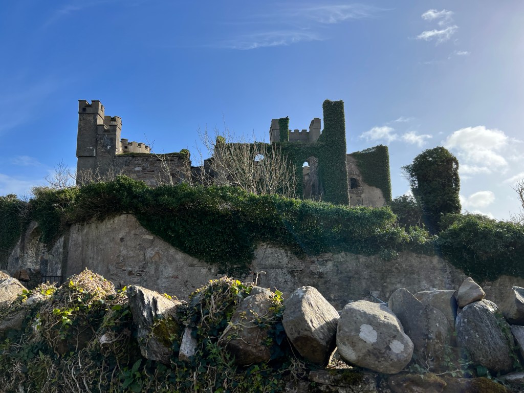
I was glad to have my hiking boots on because I had to traverse some serious mud to enter the ruins. I was the only person there and loved scrambling up and over the crumbling walls and looking at the nearby sheep through the windows. It was a worthwhile trip.
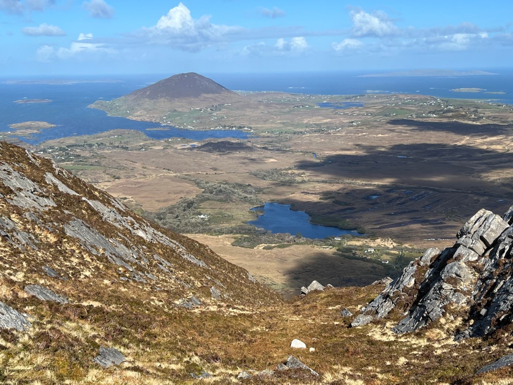
The next day the skies cleared and it was time for adventure. I took the epically beautiful Sky Road to Connemara National Park and began hiking the popular Diamond Hill before 9 a.m. to beat the crowds. A Connemara pony and her foal relaxing in a meadow was the first beautiful site on the 4.5-mile trail, the top of which had a 360-degree view of mountain ranges to the east and the Atlantic to the west.
After a few hours on the mountain, I had a quick and delicious lunch in the café at the trailhead and rushed back up the Sky Road to the car park across from Omey Island. The island is remarkable in that at low tide, you can walk across the sand from the mainland to reach it.

I arrived during low tide but was a little late for to attempt to cross the sand to the island. While the ocean hadn’t yet returned, I couldn’t risk getting stranded because I needed to work that afternoon. I wandered around on the wet sand for about a half hour and marveled at the patterns left by the receding ocean before I left, returned to my rental and spent the rest of the evening there working and packing up.
Cong, Galway and Doolin in a day
When I planned this road trip, I knew trying to fit in more of Connemara, an afternoon in Galway and a hike from the tiny town of Doolin to the most famous cliffs in Ireland was going to be a bit ambitious. After all I’d be trying to cover 130 miles in three counties, which would take nearly four hours without stops. Plus, I’d be coming off of three workdays ending at 11 p.m.
But when I woke to see my Connemara ponies’ white manes shining in the morning sunlight, I had a feeling it would be a spectacular day. I was right.
I started by driving from Clifden to the Quiet Man Bridge outside of Cong. If you haven’t seen “The Quiet Man” starring Irish goddess Maureen O’Hara and John Wayne, then this would be a pretty boring stop. But for fans of the 1952 film like myself, it’s a delight.
Next I went into the town of Cong itself, stopping at a statue of Wayne carrying O’Hara before walking onto the peaceful trails of the Cong Woods, which took me to Ashford Castle. The castle, built in 1228, looked out of a storybook.

It’s now a five-star hotel, which I knew, and closed to non-guests, which I didn’t know. I strode ignorantly through the front doors and immediately got the sense that it probably was just for hotel guests. I decided to walk around with confidence anyway and pretend I was in a different income bracket for a while.
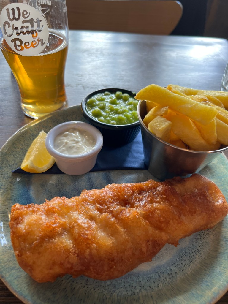
Thoroughly enchanted by the lounge and dining areas of the well-preserved castle, it was time to make my way to Galway for a city walkabout and a good lunch. I obtained the latter at Hooked, a casual, bustling spot that served me a crisp cider and the best fish and chips of my life (the mushy peas, not so much). I was unimpressed during the walk I took through Galway’s Latin Quarter and the nearby waterfront but I was also pressed for time so I’ll reserve judgment for the city for a more extended visit.
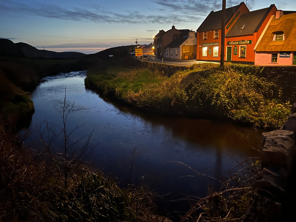
It was time to head toward Doolin and the famed Cliffs of Moher. By the time I drove an hour and a half south to Doolin and dropped by luggage off at the apartment I had rented, it was nearly 5 p.m., which felt very late for my walk.
I didn’t even take time to change out of my jeans before I walked out of Doolin and found the trail to the cliffs. I was in for a far more adventurous walk than I anticipated. It took me about two hours to get to the main lookout at the cliffs. Along the way, I dodged deep, thick mud, came across another solo female hiker whose shoes and pants were trashed by the mud and then a group of four Americans that included a man angrily and comically wiping mud off his face.
It turned out, the woman had taken a wrong turn and ended up in even worse mud than I had been tiptoeing around. The American man had fallen in it twice, though he had never gone off trail. I would later snag my jeans on a piece of barbed wire while I was trying to dodge a particularly deep bit of mud.
By the time I talked to the Americans, I’d been hiking an hour and was wondering what I had gotten myself into. Luckily, the Americans told me they had hiked down from the main viewpoint at the cliffs and had been going an hour so I learned I had made it about halfway.
Realizing I wouldn’t get to my destination until 7 p.m., I wondered aloud how I would get back to Doolin. The Americans told me their destination was Doolin and they were wondering how they’d get back to their car at the cliffs.
An idea struck me. I could take their car keys and drive to Doolin once I arrived at the viewpoint. Fortunately they realized they could trust me and had rented an automatic. I took their keys, we exchanged phone numbers and off I went, a comfortable ride home guaranteed.

The rest of the way included more mud and a steep uphill climb. I arrived to the viewpoint at 7 p.m. during magic hour, and the cliffs were magnificent. I wandered around and soaked up the views before finding the Americans’ rental in the parking lot and heading back toward Doolin.
We had decided to meet at a pub and I was looking forward to talking with them more over beers but it seems they had other plans. When I arrived, only one of them was waiting. He gratefully took back the car and we said goodbye.
Now I was on my own with no dinner plans. I had done little research. I scanned the pub for the mud-covered solo female hiker I had come across (I told her I’d be there later) but there was no sign of her.
The pub was rollicking and jam-packed. After all my exploring and hiking, I was not in the mood. Instead, I walked about a mile more into town and came upon an upscale pizza place and wine bar called the Riverside Bistro. Ding, ding, ding, we have a winner.
I proceeded to have a splendid salad and pizza and plenty of wine at the bar. It was the perfect ending to what turned out to be an exhausting but rewarding day of exploring the Wild Atlantic Way.
Killarney, Cork and Kinsale (5 nights)
On almost every extended solo trip, one leg inevitably turns out to be melancholy. On this one, it hit me on the Dingle Peninsula and continued in Killarney.
I had heard so many great things about Dingle and it was the one place I had made a dinner reservation. But on the way in from Doolin, the weather was cold and rainy. Unlike some other lucky days I’d had where the sun eventually emerged, Dingle was socked in when I arrived after a long drive, during which I had a sad, dry scone from Limerick and got caught on a two-lane road behind a cycling race, delaying me at least an hour.
I walked around and found a cozy bookstore, bought a book and walked to a nearby café where I decided to wait and see if the weather would turn around and I could go exploring the peninsula.
I had so much planned for Dingle but I was tired, experiencing a little loneliness and all I wanted to do was put on comfy clothes, make hot tea and read under a blanket. So I ditched Dingle and drove an hour and a half to my Airbnb in Killarney.
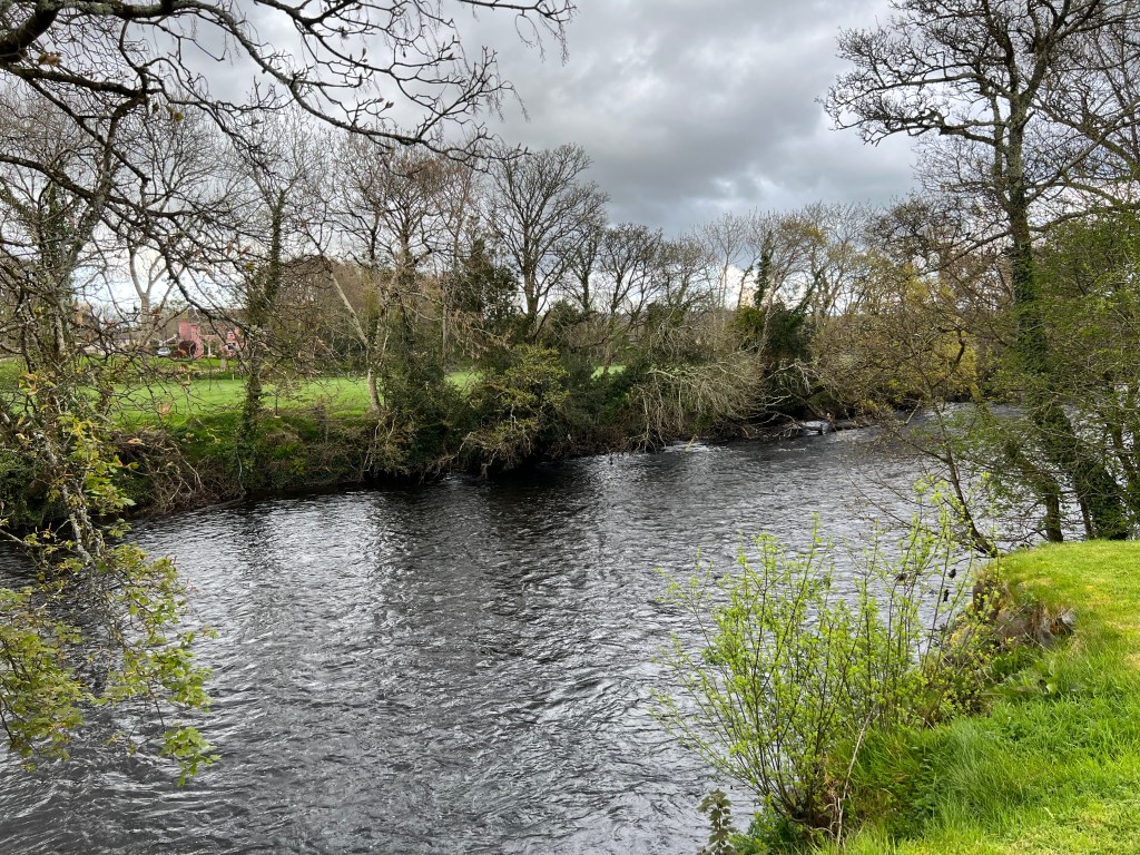
It was dreary there, as well, but my apartment rental had a serene view of the River Laune, a comfortable couch, a big throw blanket and a tea kettle. My hosts were thoughtful enough to also provide fresh cheddar cheese and crackers, which really hit the spot.
I barely moved until it was time to get up the next morning and drive the Ring of Kerry and Skellig Ring. Though it looked to be a beautiful day out my window, the hour-long drive to the beginning of the Ring of Kerry quickly turned foggy and my melancholy, though better, was lingering.

Unlike Dingle, I was determined to make the most of my day despite the weather and my mood. I had a couple mostly unremarkable, foggy hikes that would have had killer views on a clear day (Kerry Cliffs and Bray Head Loop) but I had a surprisingly good time at Valentia Lighthouse. There, I learned about the unique and challenging lives of lighthouse keepers and their families. It may not sound that interesting but I was engrossed.
I also was excited to touch a piece of the first transatlantic cable, which ran from Valentia Island to Newfoundland, Canada, and made real-time communication possible between North America and Europe in 1858. Continuing my nerdy travels, I left the lighthouse and made my way to look at the island’s famed tetrapod tracks. The tracks are some 385 million years old and were made by some of the world’s first four-legged creatures.
Satisfied with my day’s jaunt, I made my way back to my apartment for more cozy reading. Bad weather continued the next day when I was to explore the Gap of Dunloe. I made it out to the famed road and even walked it for about 2 miles roundtrip, but there was such little visibility and the rain so persistent, that it was a fruitless effort. I ended up at the nearby Coffee Pot Cafe, where I ate delicious food, drank comforting warm beverages and met a sweet local artist named Betty Rohan.
The next two nights I spent with friends in Cork, where I enjoyed climbing up Shandon Tower, ringing the church bells myself, exploring the English Market and Saint Fin Barre’s Cathedral, and strolling around lovely University College Cork.
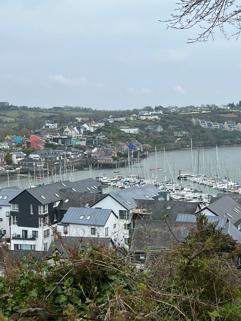
I ended my exploration of the Wild Atlantic Way with a quick day trip down to picturesque town of Kinsale, where we shopped, ate dosa from a food truck and met up at another friend’s house for tea and cookies.
The next day I was on a bus to Dublin, where I caught a plane to Glasgow, Scotland, to begin a three-week trip that included a solo hike of the 96-mile West Highland Way.
___
Related:
